top of page
Clarkston DDA Strategic Plan
As a Graduate Research Assistant with Georgia Tech’s Center for Economic Development Research (CEDR), I served as a primary GIS and analytical contributor to the City of Clarkston Downtown Development Authority Strategic Plan.
Clarkston had limited and outdated GIS information available for the project, so I helped build the spatial foundation needed for the study. I created and updated parcel-level datasets for zoning, existing land use, business type, points of interest, and other downtown conditions; incorporated Census, commercial-market, and local planning data; and produced publication-ready maps for the strategic plan.
I also designed the project’s windshield-survey workflow and ArcGIS Field Maps system used by the team for on-site data collection. I configured conditional visualization and field logic, helped complete field observations, and used recent imagery and secondary research to fill remaining data gaps. The completed GIS layers were packaged and delivered back to the City of Clarkston for future municipal use.
Beyond GIS, I contributed demographic analysis, business-survey interpretation, retail and market analysis, stakeholder interview synthesis, charts, written takeaways, and community-engagement research. The project combined spatial data creation, fieldwork, market research, and stakeholder input to support recommendations around placemaking, small-business support, housing, and relationship building.
Project type
GIS & Economic Development
Date
Spring 2026 - Present
Location
Clarkston, Georgia
Skills & Tools
GIS · Economic Development · ArcGIS Online · Field Maps · Parcel Analysis · Zoning & Land Use · Community Engagement · Market Analysis

01
Clarkston DDA Strategic Plan

01
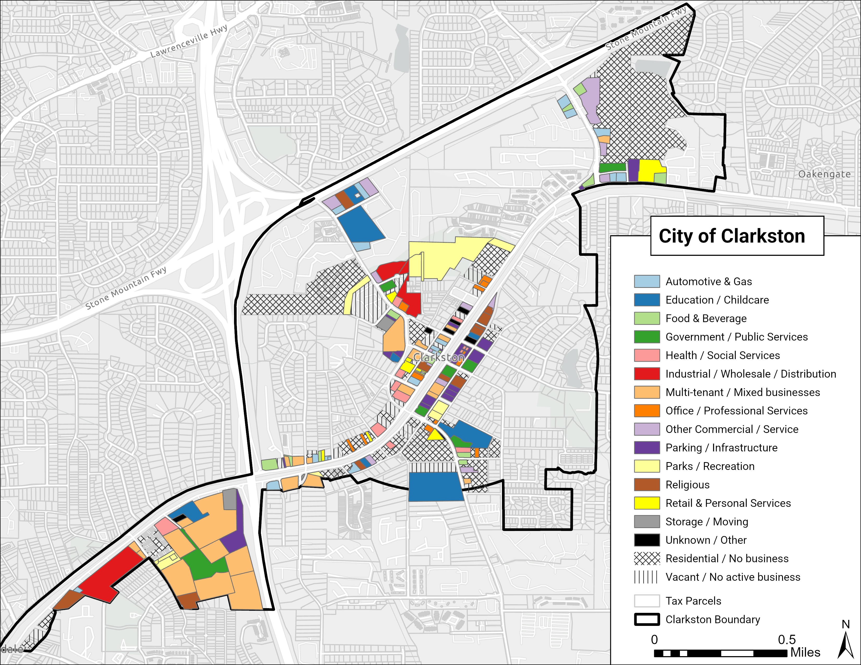
Parcel-Level Business Inventory
I built and classified a parcel-level business inventory across the DDA, distinguishing active businesses, residential parcels, vacancies, public services, retail, professional services, industrial uses, and other commercial activity. This dataset became part of the GIS package delivered back to the City of Clarkston.

02
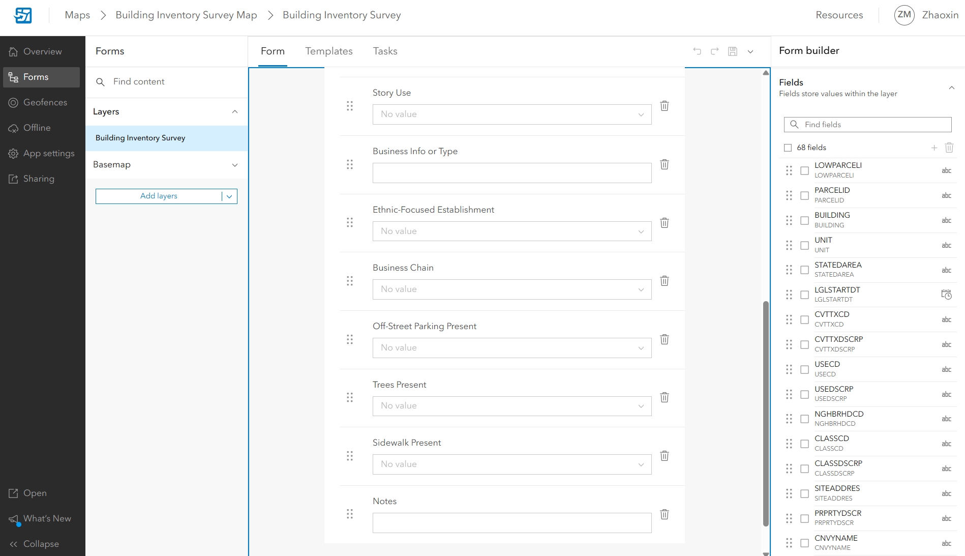
Windshield Survey Design & Field Workflow
I designed the windshield-survey instrument and ArcGIS Field Maps workflow used by the project team to collect parcel-level observations in Clarkston. I structured the survey questions, configured fields and conditional visualization, and developed a standardized mobile workflow for documenting downtown conditions.

03
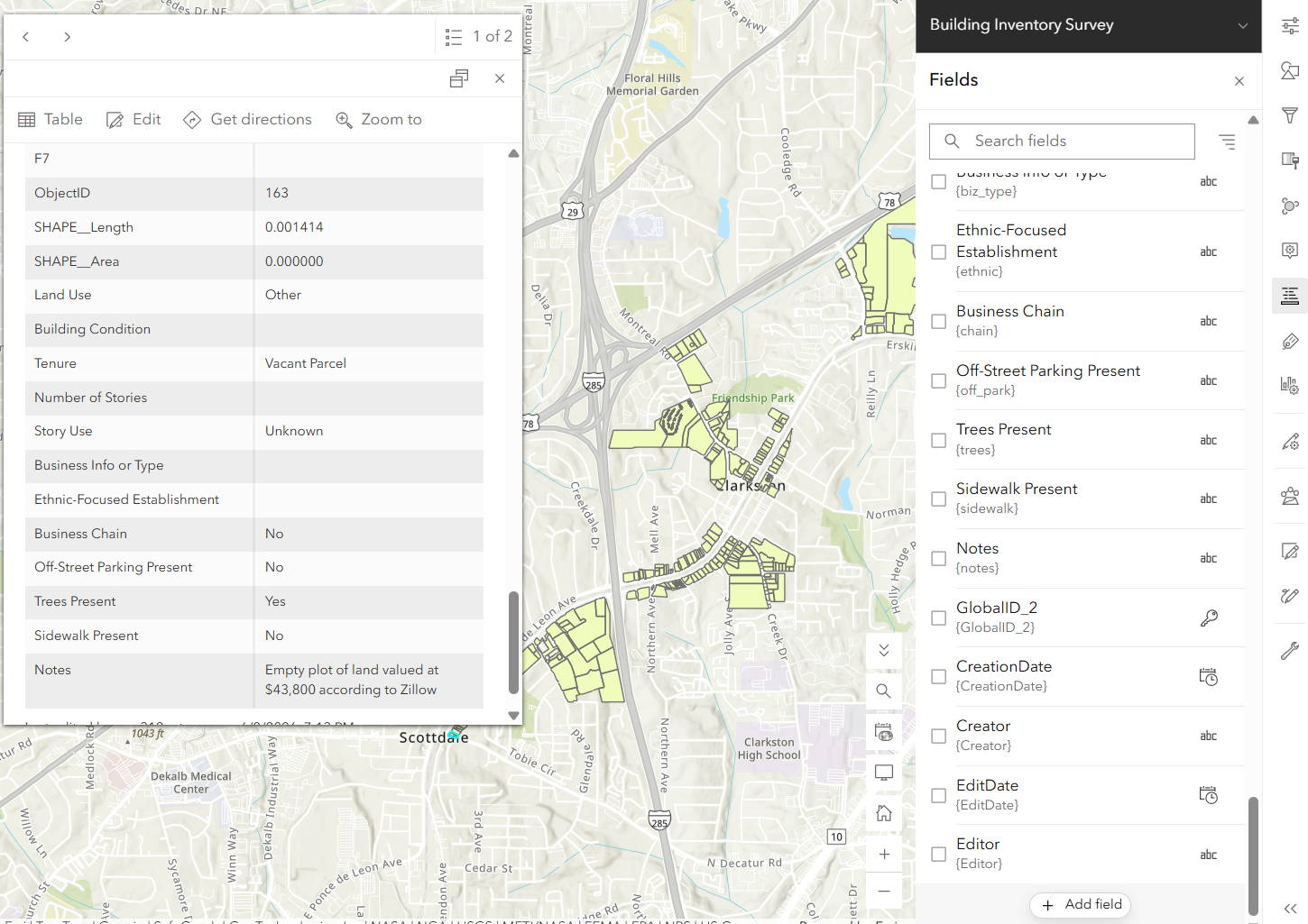
Interactive Field Survey & Parcel Database
Field observations were integrated into an interactive ArcGIS Online map for spatial review and verification. I maintained the underlying parcel data, incorporated field observations, and filled remaining information gaps using recent imagery and secondary research to create a more complete downtown inventory.

04
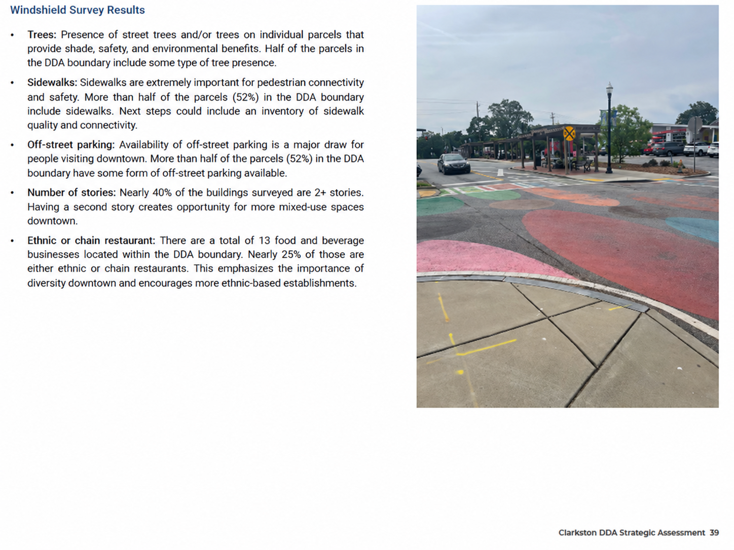
Windshield Survey Findings
I translated the collected field data into planning findings on tree coverage, sidewalk availability, off-street parking, building height, and downtown food and beverage activity. The results helped identify infrastructure and placemaking conditions relevant to the DDA strategic plan.

05
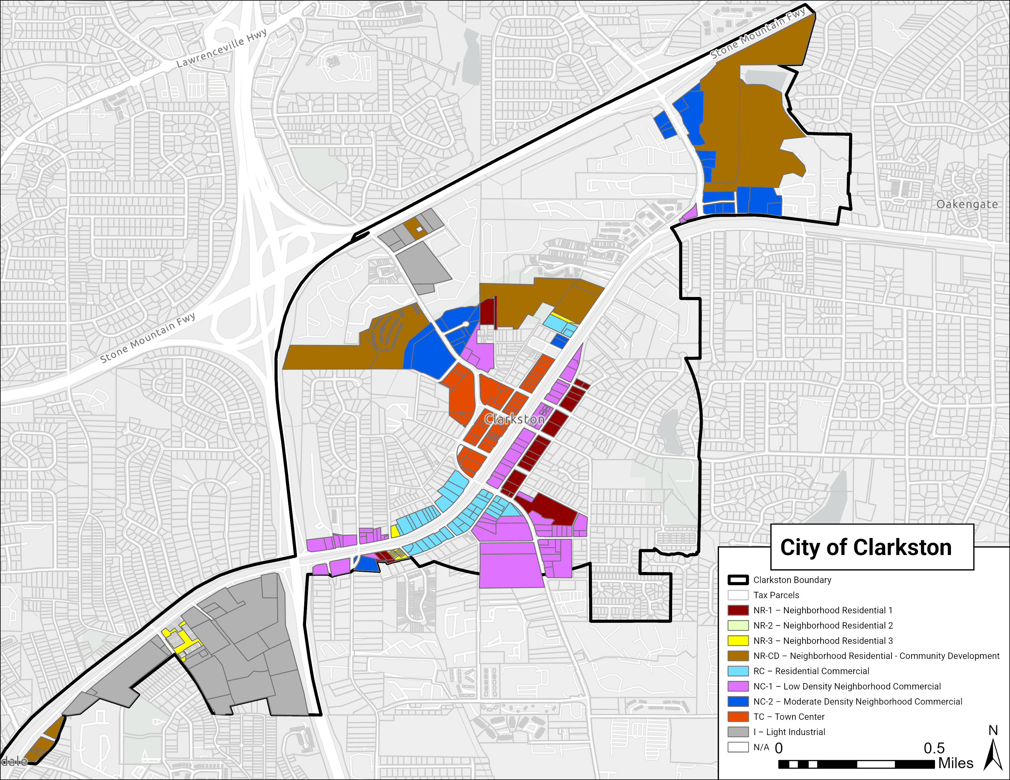
Updated Zoning Inventory
I updated and mapped Clarkston’s parcel-level zoning using current local zoning codes and classifications. Because the city had limited up-to-date GIS available, this work created a more usable spatial reference for the strategic plan and future municipal planning.

06
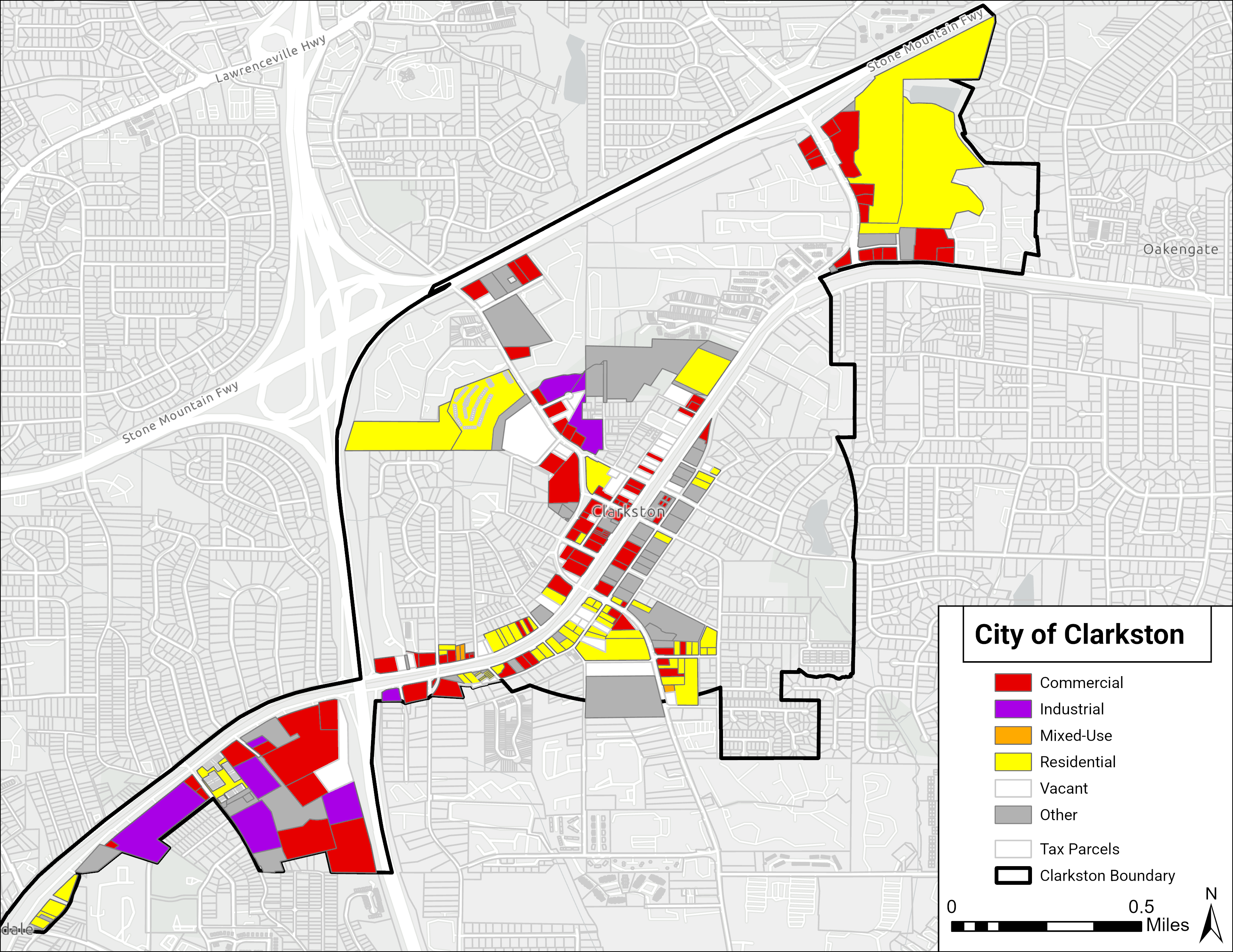
Existing Land Use Analysis
I created an updated existing land-use dataset for the DDA, classifying parcels as commercial, industrial, mixed-use, residential, vacant, and other uses to support redevelopment and downtown planning analysis.

07
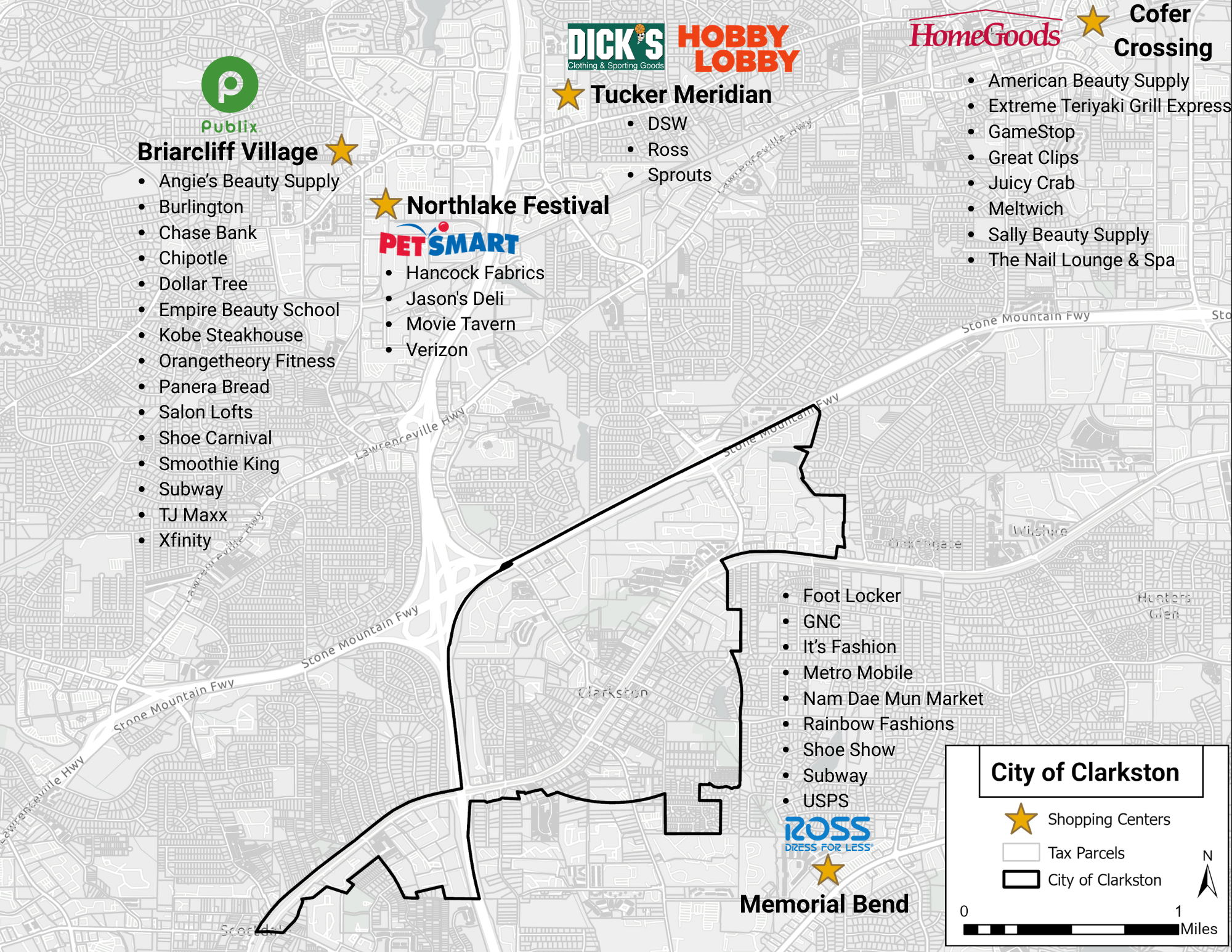
Retail Leakage & Outshopping Analysis
I supported retail-market analysis by combining commercial and location data with spatial visualization to identify where Clarkston residents shop outside the district and which competing commercial centers capture local demand. The findings helped inform business recruitment and downtown economic-development strategy.

08
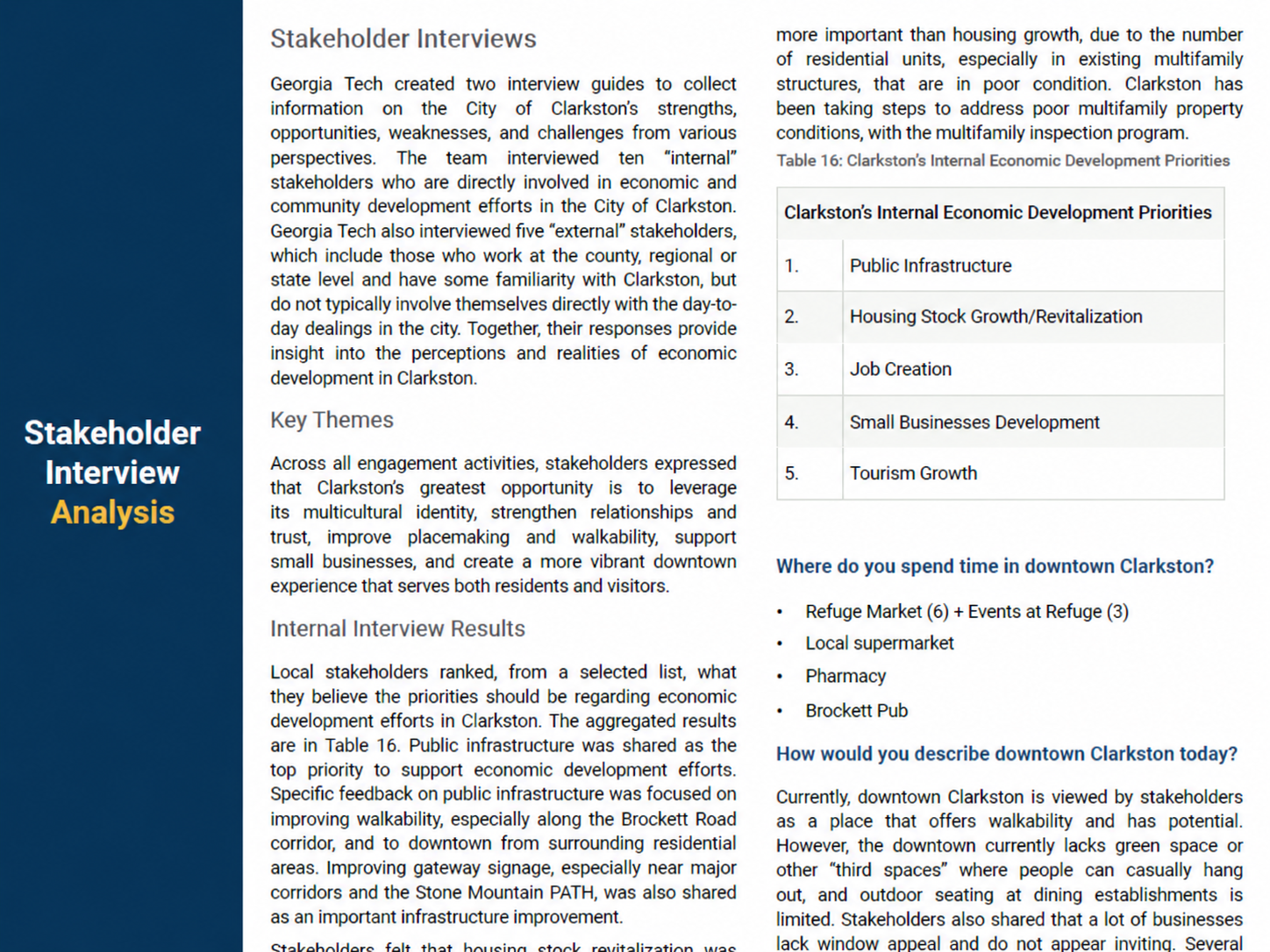
Stakeholder Priorities & Downtown Strategy
I helped synthesize stakeholder interviews and engagement findings into recurring priorities involving public infrastructure, housing revitalization, small-business development, placemaking, walkability, and downtown identity. These findings helped connect quantitative analysis with community and stakeholder perspectives.

09
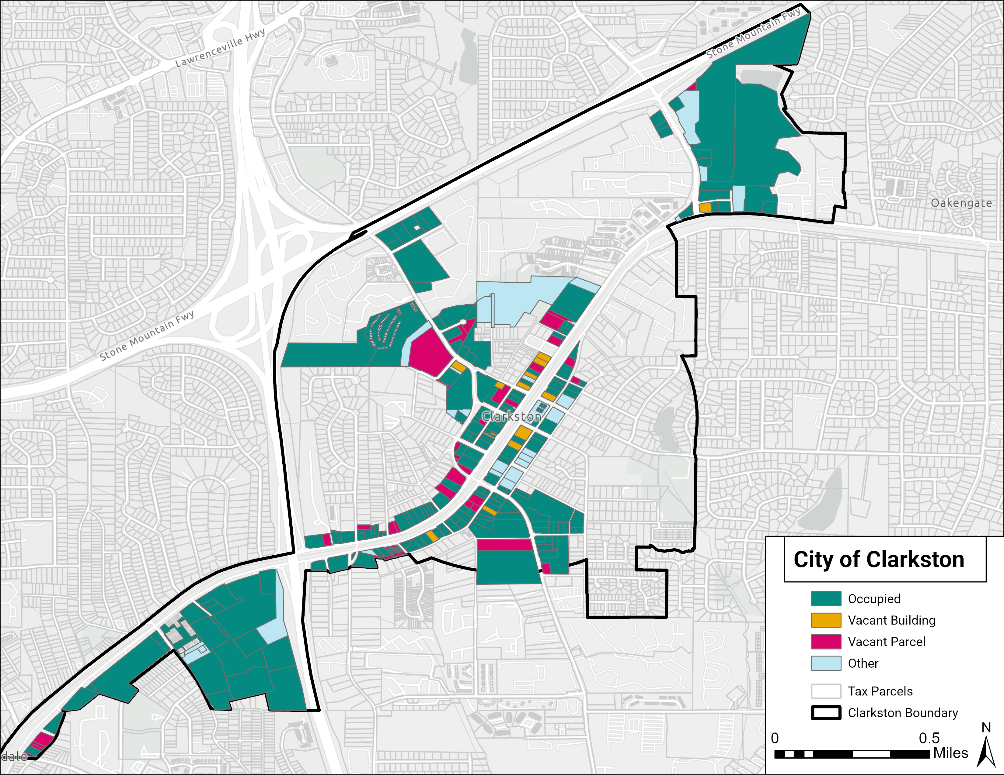
Building Tenure & Vacancy
I mapped building tenure and vacancy conditions within the DDA to help identify occupied properties, vacancies, and redevelopment opportunities throughout downtown Clarkston.

10
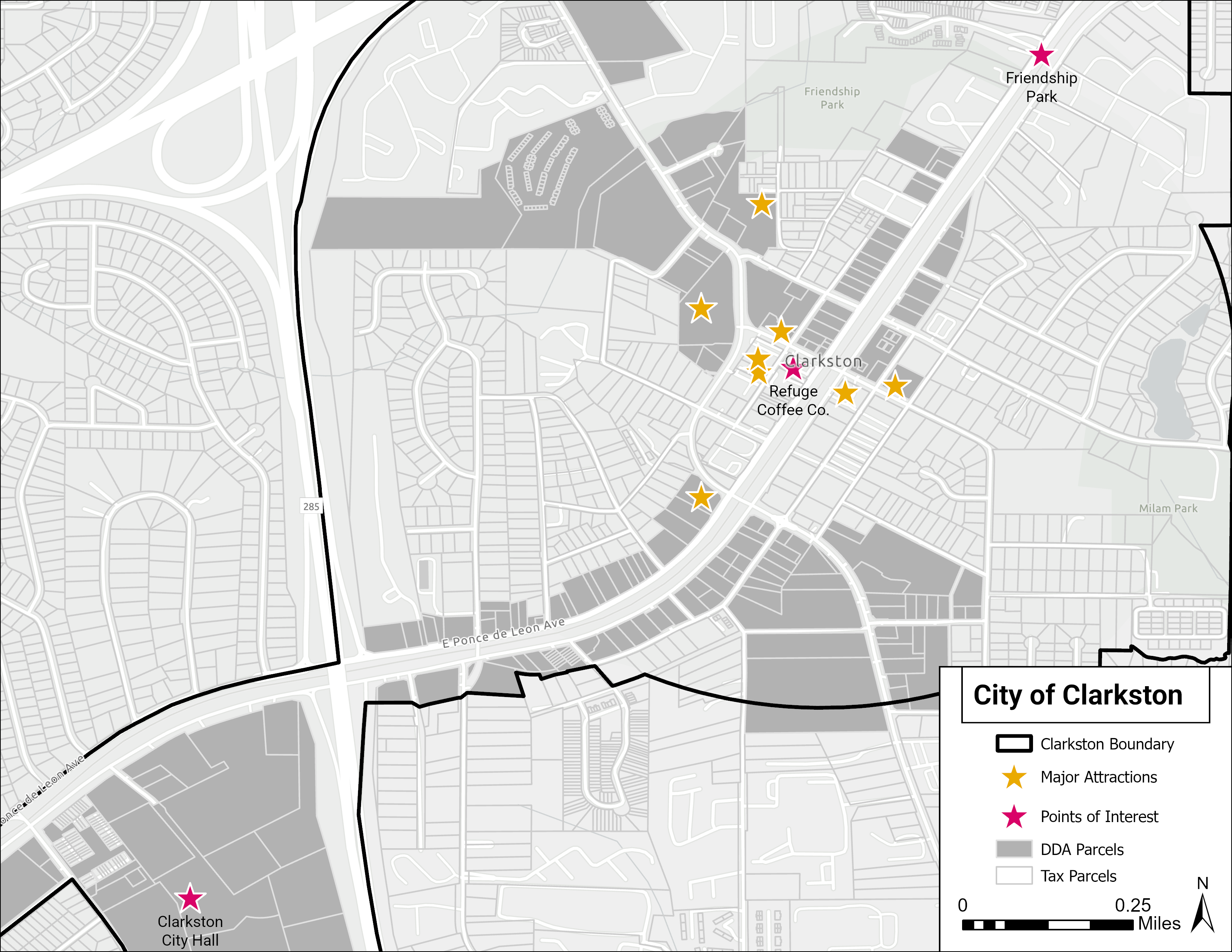
Downtown Assets & Points of Interest
I mapped major attractions, civic destinations, and other points of interest in relation to DDA parcels to support analysis of downtown activity, placemaking, connectivity, and visitor destinations.
- Parcel-Level Business Inventory
- Windshield Survey Design & Field Workflow
- Interactive Field Survey & Parcel Database
- Windshield Survey Findings
- Updated Zoning Inventory
- Existing Land Use Analysis
- Retail Leakage & Outshopping Analysis
- Stakeholder Priorities & Downtown Strategy
- Building Tenure & Vacancy
- Downtown Assets & Points of Interest
bottom of page