top of page
Urban2Orbit: Lunar Site Selection & Infrastructure Planning
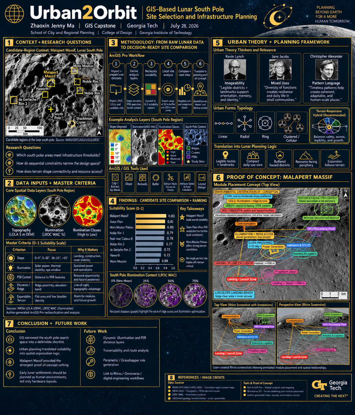
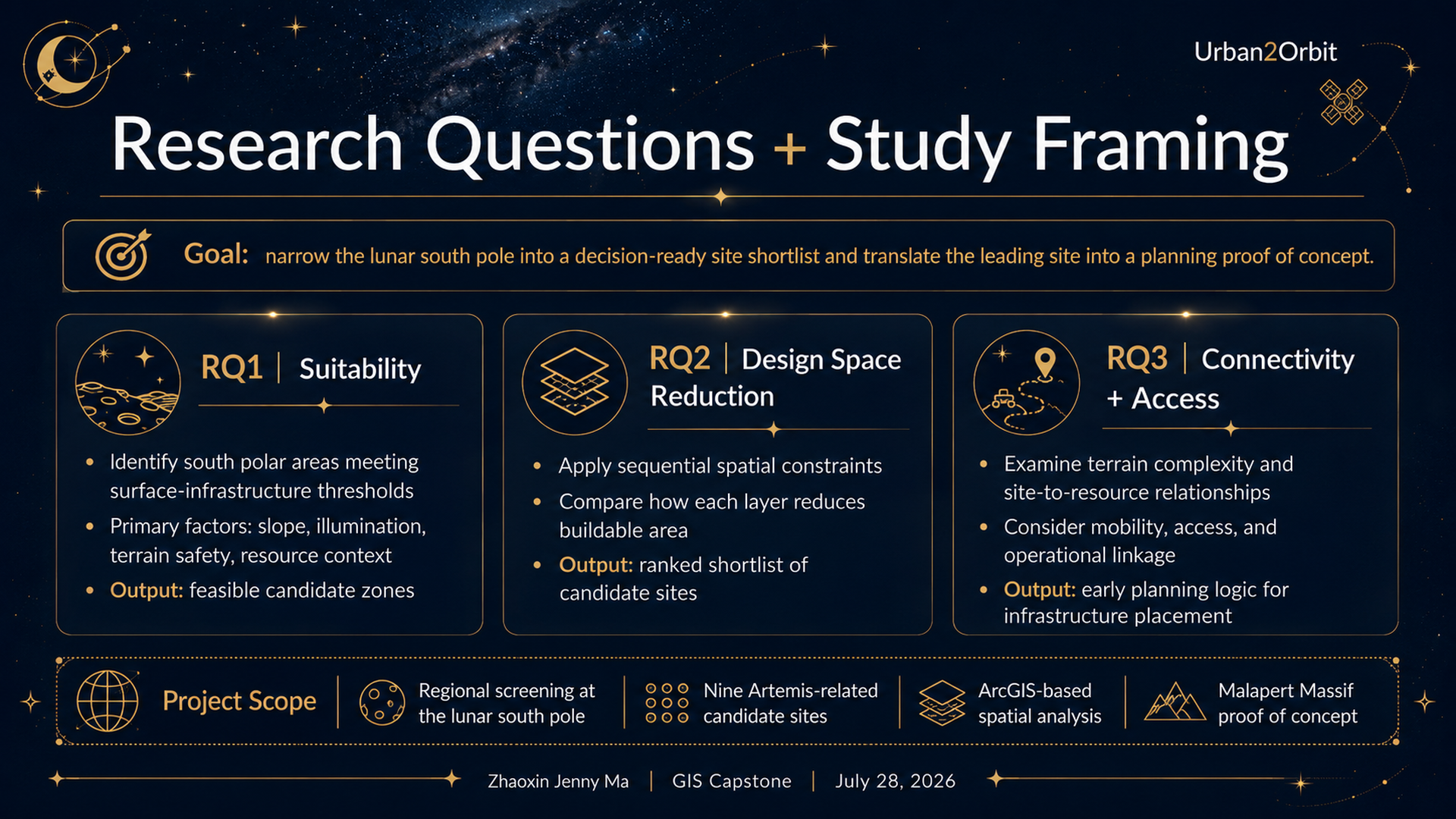
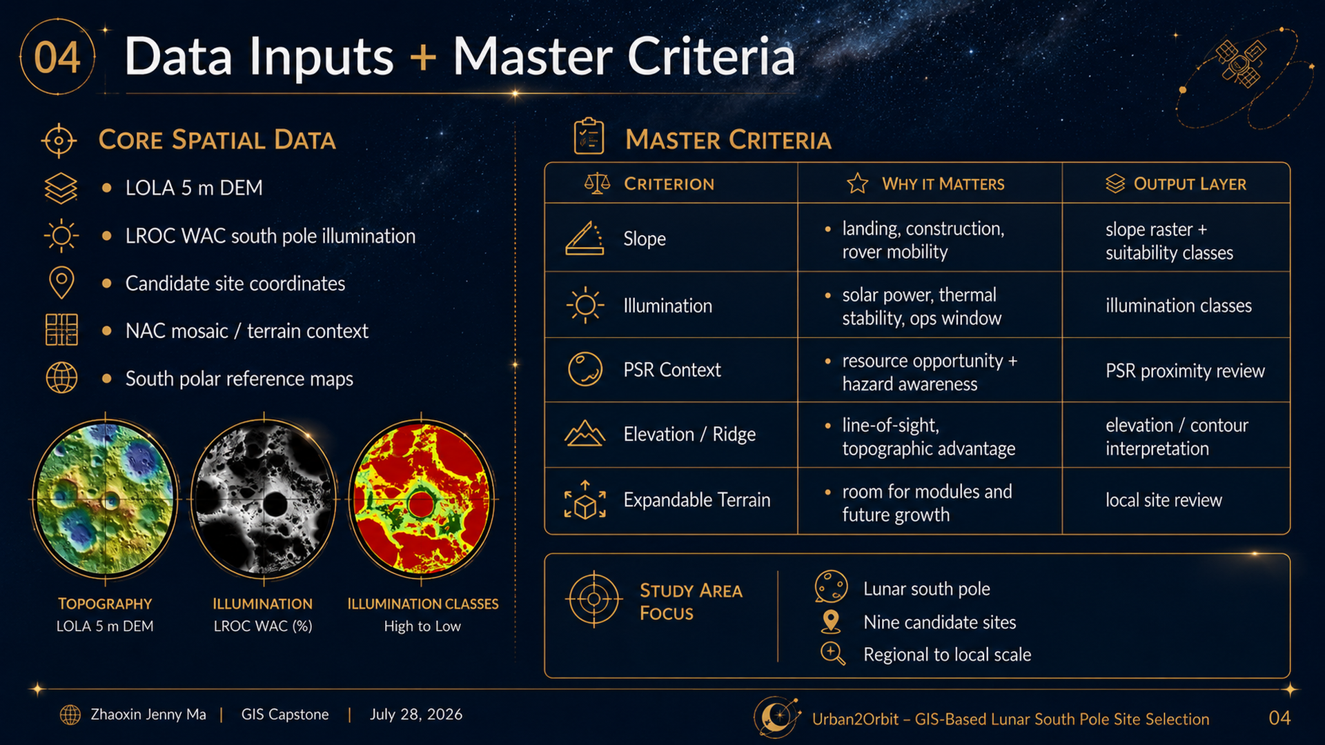
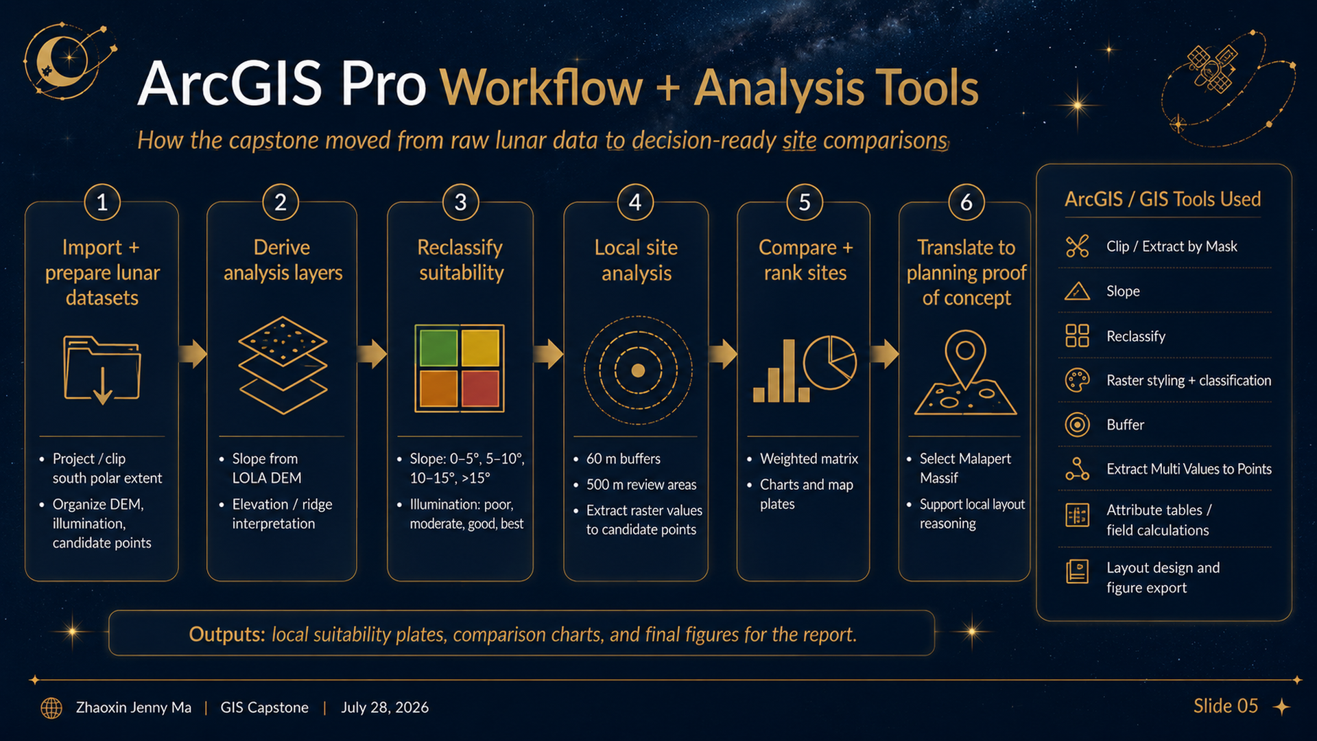
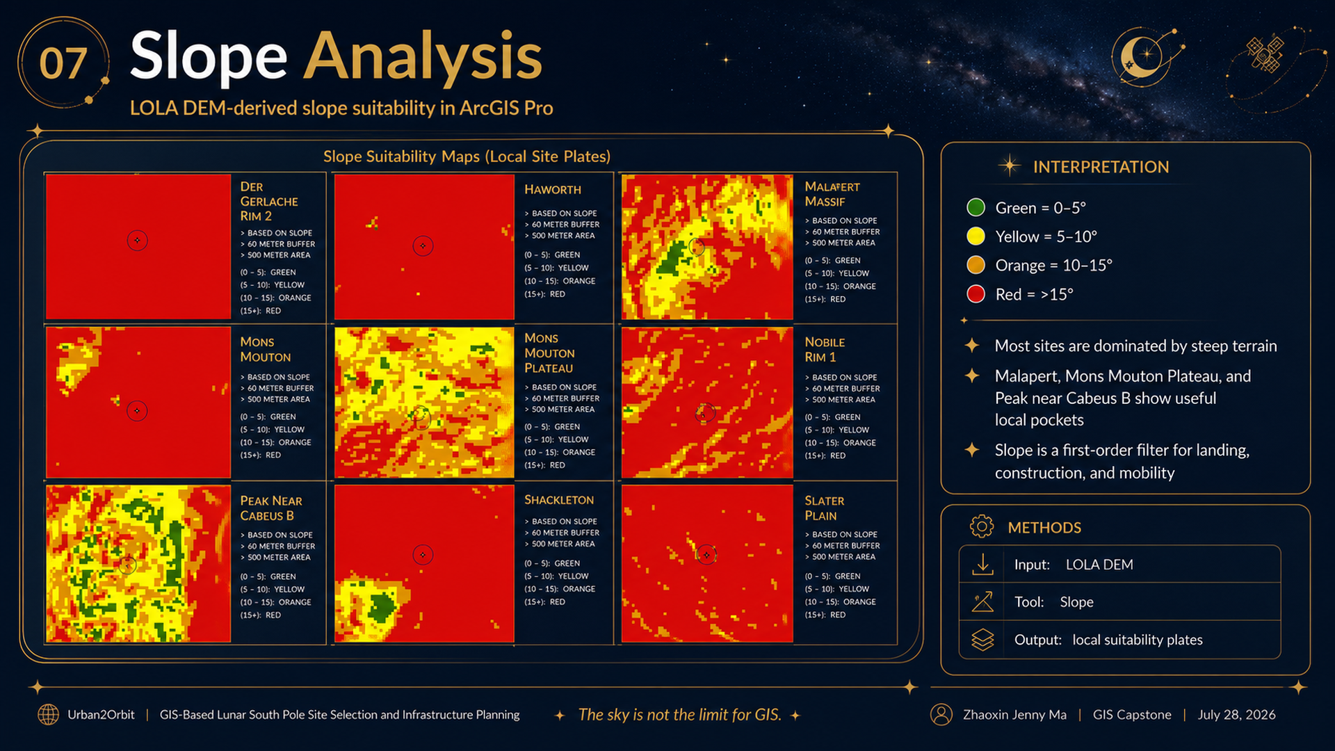
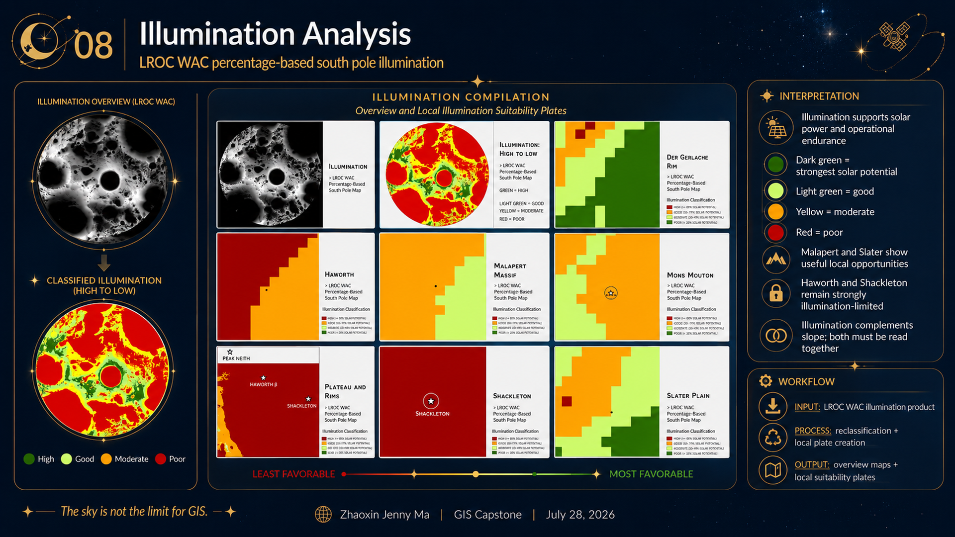
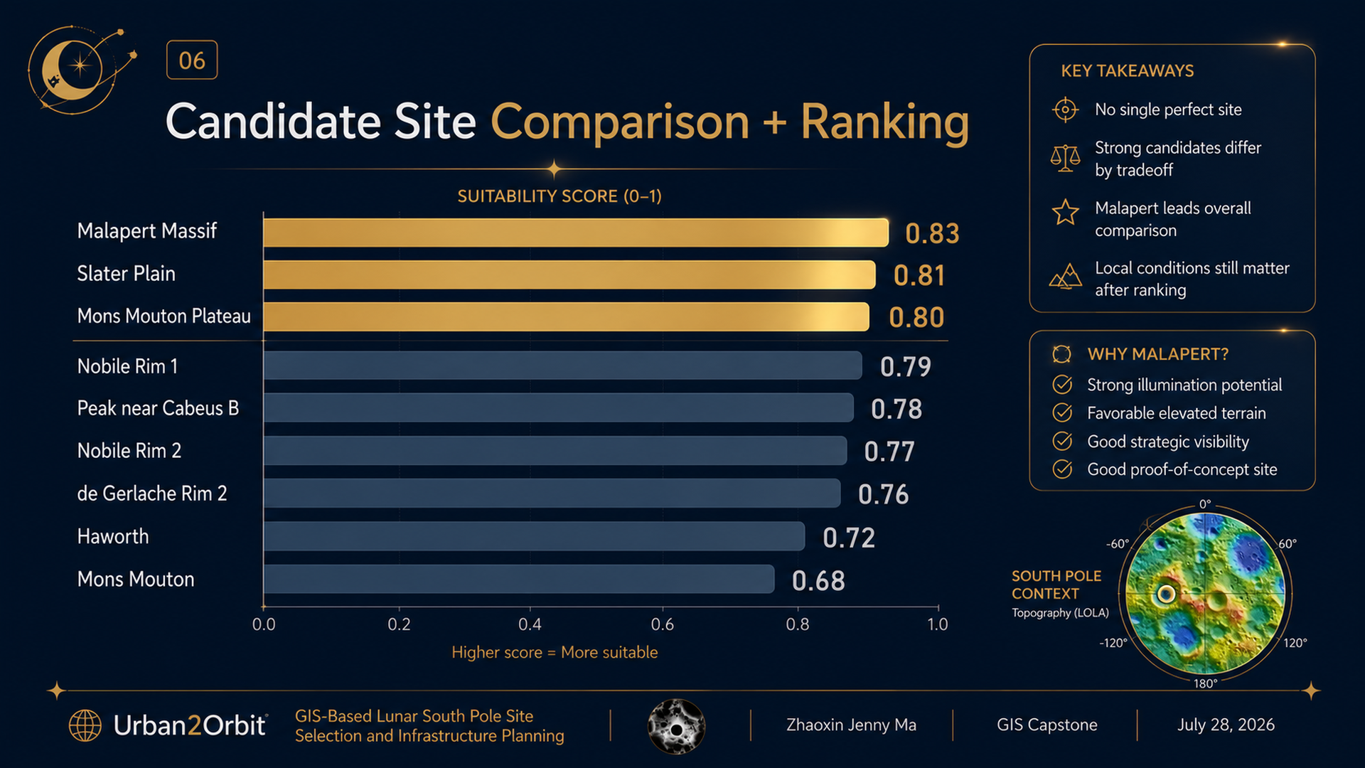
Urban2Orbit is an ongoing research initiative applying GIS, spatial analytics, urban planning, and 3D design to future lunar settlements. Using ArcGIS Pro and NASA/LRO lunar datasets, I analyzed slope, illumination, elevation, PSR proximity, and expandable terrain across nine South Pole candidate regions using a multi-criteria suitability framework. I then translated the results into a 5 km × 5 km infrastructure concept at Malapert Massif, using Rhino 8 and Python to explore placement of habitation, power, communications, landing operations, logistics, and ISRU systems. The work connects geospatial analysis with urban planning and digital-engineering workflows.
Project type
GIS • Spatial Analytics • Urban Planning • 3D Design
Date
September 2025 - Present
Location
Georgia Institute of Technology • Atlanta, GA
MS-GIST Capstone Link
Skills & Tools
GIS · Spatial Analysis · Lunar Planning · Site Selection · Urban Design · 3D Modeling · ArcGIS Pro · Rhino

01
Urban2Orbit: Lunar Site Selection & Infrastructure Planning

01

02
02_Research_Questions_and_Study_Framing 1

03
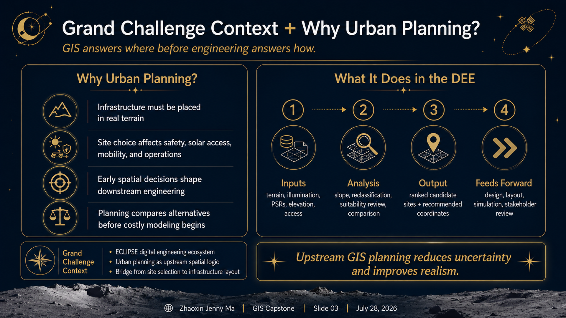
03_Grand_Challenge_and_Urban_Planning_Context 1

04
04_Data_Inputs_and_Master_Criteria 1

05
05_ArcGIS_Pro_Workflow_and_Analysis_Tools 1

06
07_Slope_Analysis 1

07
08_Illumination_Analysis 1

08
06_Candidate_Site_Comparison_and_Ranking 1

09
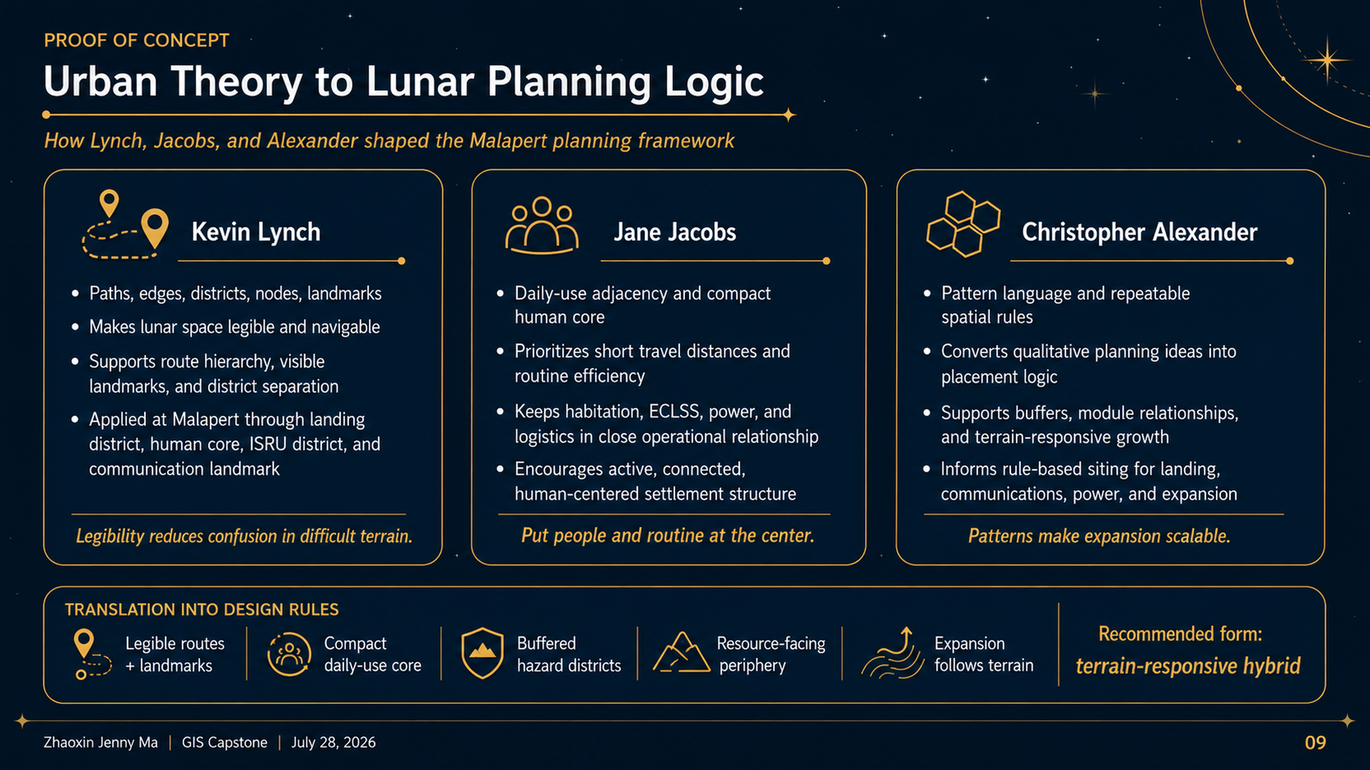
09_Urban_Theory_to_Lunar_Planning_Logic 1

10
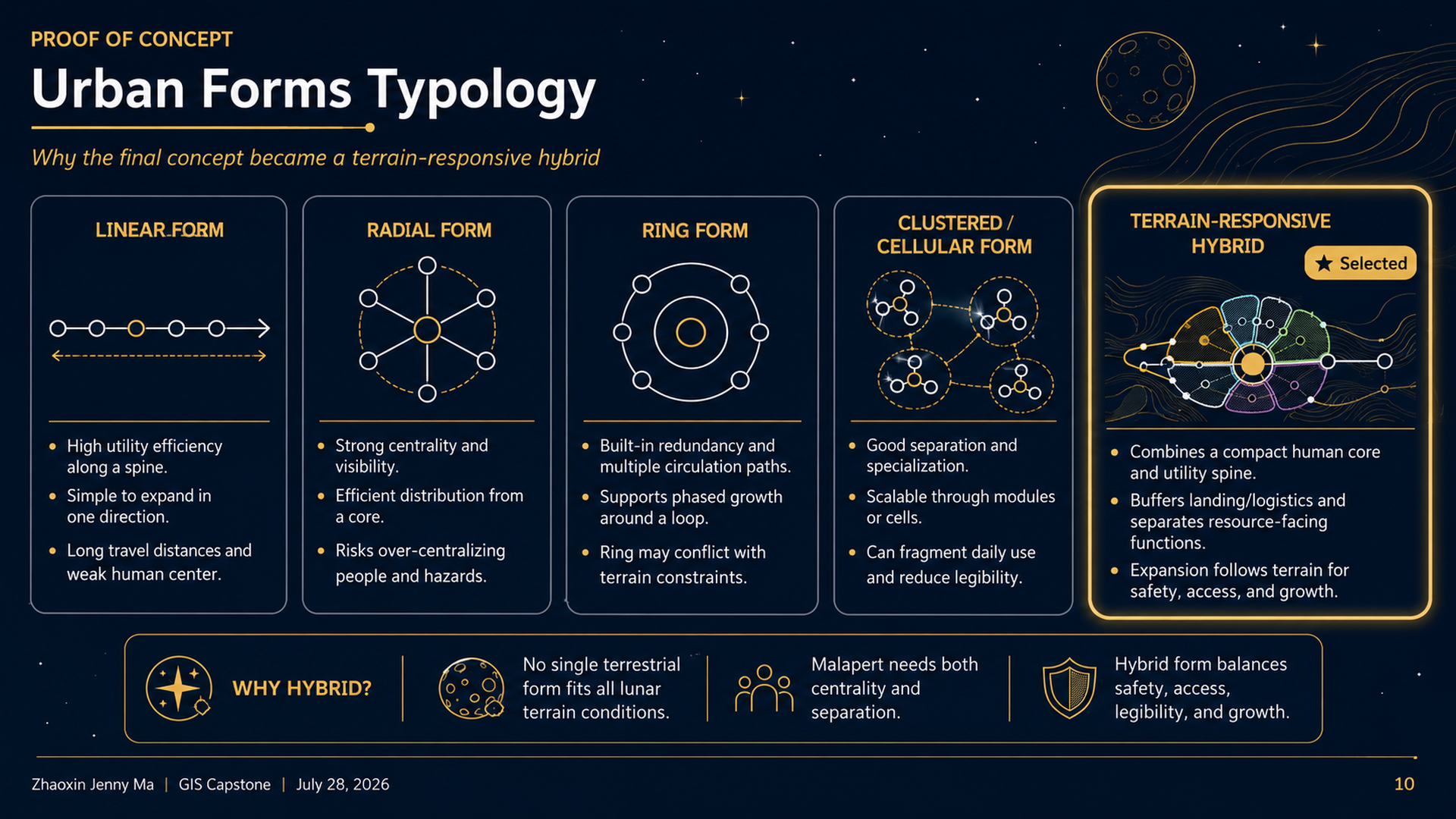
10_Urban_Forms_Typology 1

11
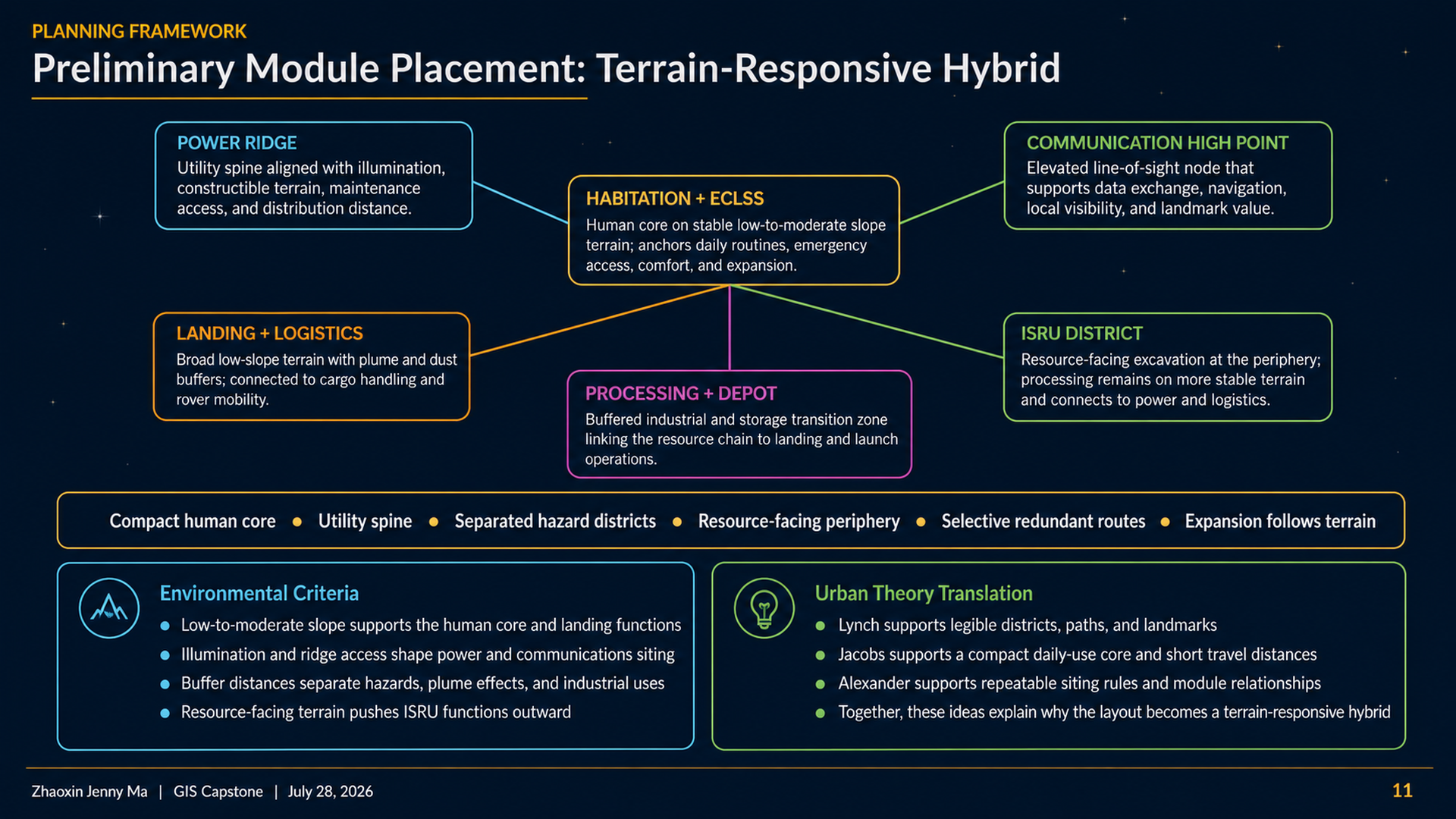
11_Preliminary_Module_Placement 1

12
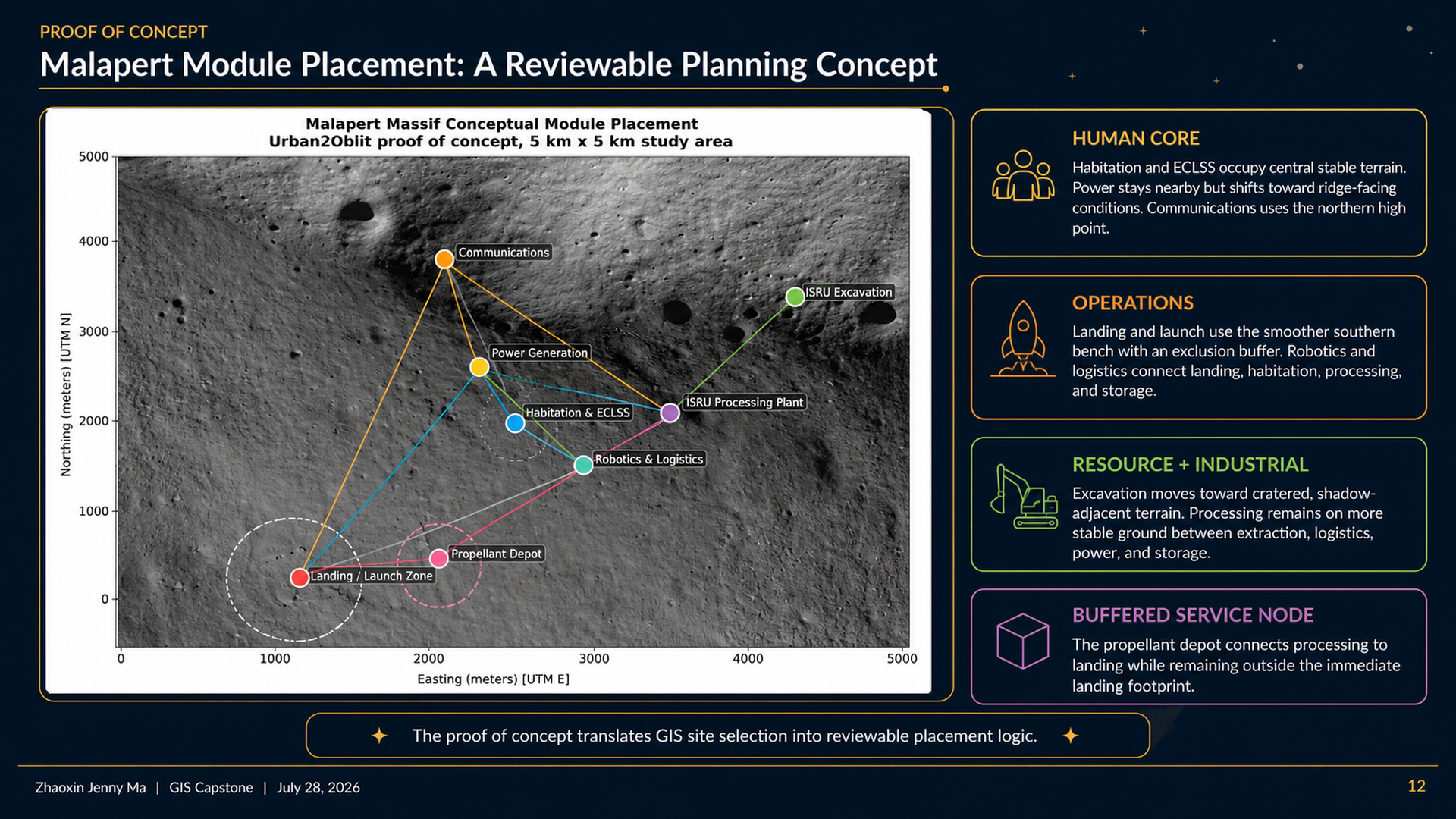
12_Malapert_Module_Placement_Rhino_Findings 1
- 02_Research_Questions_and_Study_Framing 1
- 03_Grand_Challenge_and_Urban_Planning_Context 1
- 04_Data_Inputs_and_Master_Criteria 1
- 05_ArcGIS_Pro_Workflow_and_Analysis_Tools 1
- 07_Slope_Analysis 1
- 08_Illumination_Analysis 1
- 06_Candidate_Site_Comparison_and_Ranking 1
- 09_Urban_Theory_to_Lunar_Planning_Logic 1
- 10_Urban_Forms_Typology 1
- 11_Preliminary_Module_Placement 1
- 12_Malapert_Module_Placement_Rhino_Findings 1
bottom of page