top of page
Airport Proximity & Public Health in Georgia
This individual Public Health Analytics project examined whether proximity to Georgia’s major commercial airports is associated with elevated respiratory and cardiovascular health risk and whether those health outcomes exhibit significant spatial clustering.
I assembled census-tract data from CDC PLACES, the American Community Survey, FAA airport datasets, and U.S. Census TIGER/Line boundaries, then integrated the datasets for spatial analysis across Georgia. The analysis focused on Hartsfield-Jackson Atlanta International Airport, Savannah/Hilton Head International Airport, and Augusta Regional Airport and used five-mile airport exposure zones to explore potential relationships between aviation activity and surrounding community health.
The project combined ArcGIS Pro mapping, principal component analysis, GeoDa spatial statistics, Moran’s I and LISA cluster analysis, and regression modeling. Results showed significant spatial clustering in both asthma and cardiovascular health outcomes, but the geographic patterns differed. Asthma hotspots showed notable relationships with major-airport areas, while cardiovascular deprivation was more strongly concentrated across rural and southern Georgia, suggesting broader socioeconomic health disparities.
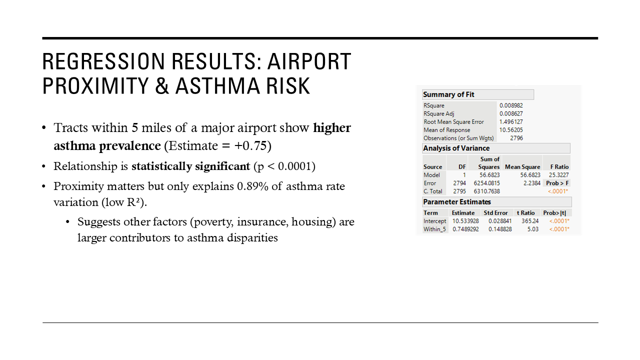
Regression analysis found that census tracts within five miles of a major airport had, on average, approximately 0.75 percentage points higher asthma prevalence. The relationship was statistically significant, although airport proximity alone explained less than 1% of overall asthma variation, highlighting the importance of broader social, environmental, and health-access factors.
Project type
Public Health GIS & Spatial Analytics
Date
Spring 2025
Location
Georgia
Tools & Skills
Public Health GIS • Spatial Analytics • Environmental Health • Environmental Justice • ArcGIS Pro • GeoDa • JMP • Moran’s I • LISA • PCA • Regression Analysis • CDC PLACES • Census Data • Aviation • Health Equity • Data Visualization
Key Sources
CDC PLACES — Local Data for Better Health
Used for census-tract asthma and coronary heart disease prevalence estimates.
U.S. Census Bureau — American Community Survey
Used for poverty, vehicle access, age, rent burden, and other socioeconomic indicators.
U.S. Census Bureau — TIGER/Line Shapefiles
Used for Georgia census-tract geography and spatial joins.
Federal Aviation Administration — Airport Data & Frequency Viewer
Used for airport locations and airport-activity context.
Georgia Airports Association
Used to identify and contextualize Georgia airport facilities.
Social Explorer
Used to access and organize ACS demographic indicators.

01
Airport Proximity & Public Health in Georgia

01
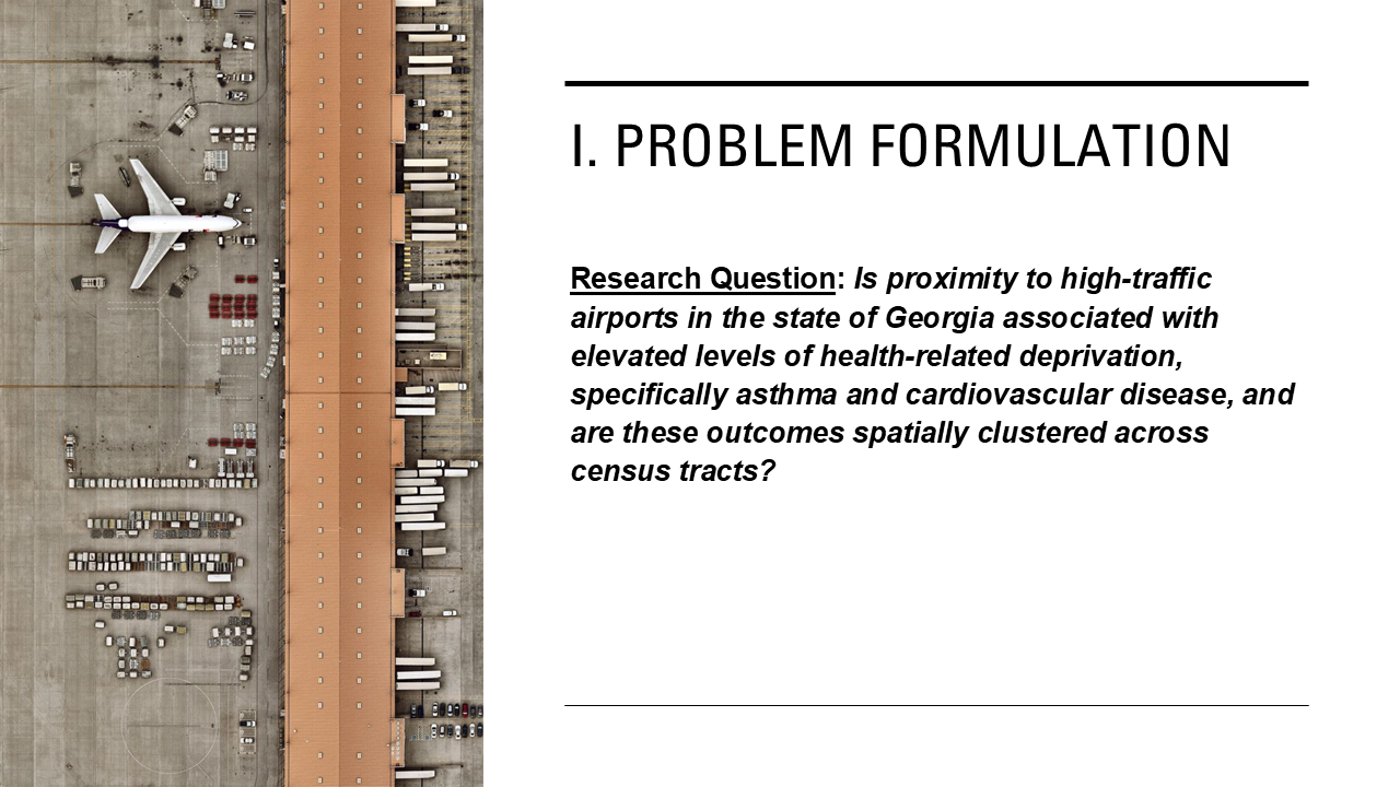
Research Question & Problem Formulation
Project overview examining how proximity to major Georgia airports may relate to asthma and cardiovascular-health patterns, combining GIS, public-health data, and spatial statistics.
The study asks whether proximity to high-traffic airports is associated with elevated asthma and cardiovascular-health deprivation and whether those outcomes form statistically significant spatial clusters across Georgia census tracts.
The study asks whether proximity to high-traffic airports is associated with elevated asthma and cardiovascular-health deprivation and whether those outcomes form statistically significant spatial clusters across Georgia census tracts.

02
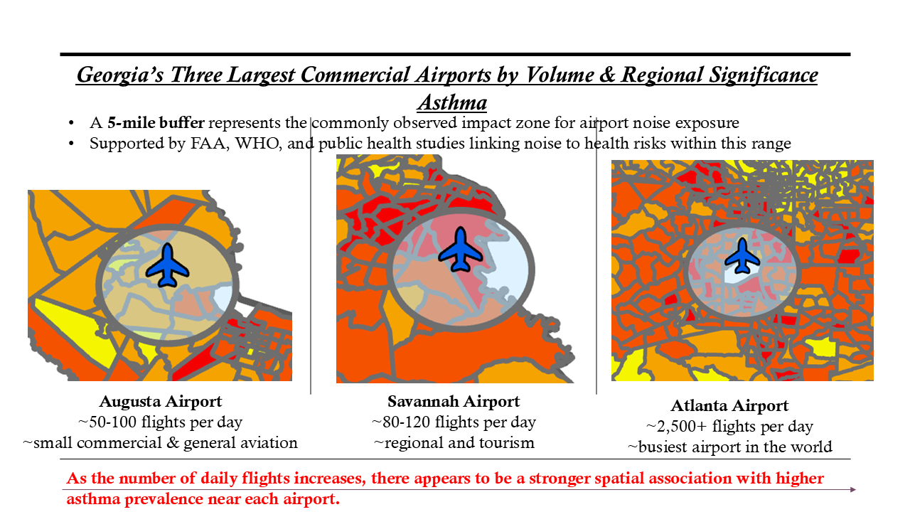
Asthma Patterns Around Georgia’s Major Airports
Compared asthma prevalence around ATL, Savannah/Hilton Head, and Augusta Regional using five-mile exposure areas informed by aviation-noise and public-health literature.

03
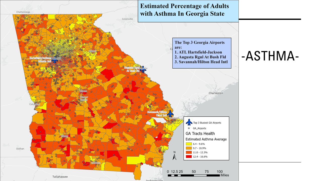
Statewide Asthma Prevalence & Airport Locations
Mapped CDC PLACES asthma prevalence across Georgia census tracts alongside airport locations to identify statewide respiratory-health patterns and visually examine conditions surrounding major commercial airports.

04
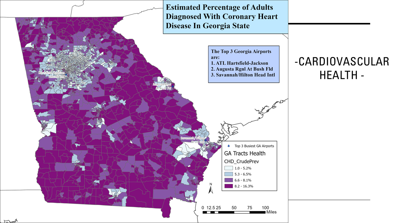
Statewide Cardiovascular Health Patterns
Mapped coronary heart disease prevalence across Georgia to determine whether cardiovascular-health patterns followed the same geographic distribution observed for asthma.

05
Cardiovascular Health Around Major Airports
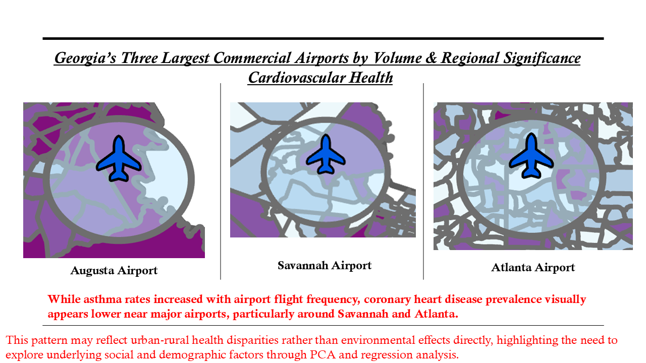
Compared cardiovascular-health conditions surrounding Georgia’s three major commercial airports. Unlike asthma, cardiovascular prevalence appeared lower near some major airport areas, suggesting that broader urban-rural and socioeconomic patterns required further analysis.

06
Respiratory Risk: Principal Component Analysis
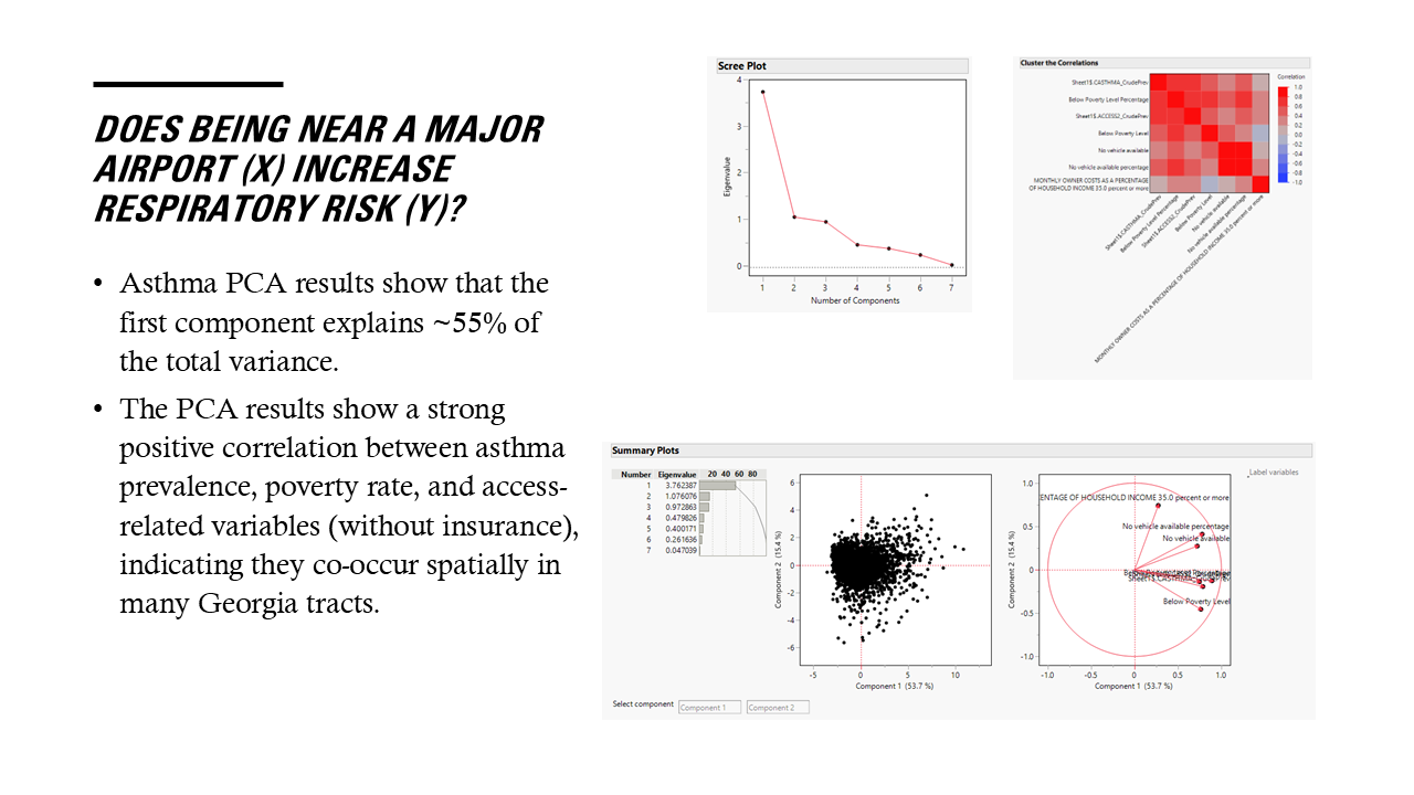
Used PCA to examine relationships among asthma prevalence and socioeconomic-vulnerability indicators and to develop a more comprehensive respiratory-risk measure rather than relying on a single health variable.

07
Cardiovascular Risk: Principal Component Analysis
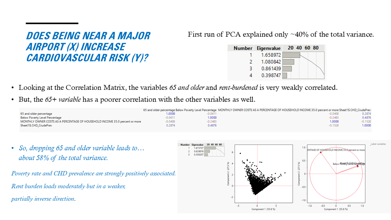
Refined the cardiovascular PCA by evaluating weakly correlated variables and identifying a stronger shared deprivation pattern. The first component ultimately explained about 55.8% of total variance, with poverty and coronary heart disease strongly co-loading.

08
Spatial Clustering of Asthma
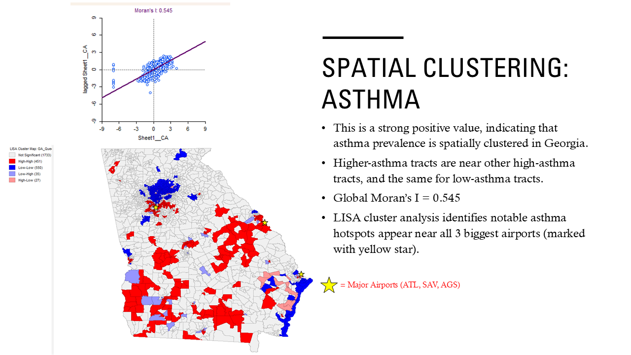
GeoDa Moran’s I and LISA analysis identified statistically significant geographic clustering in asthma prevalence, distinguishing local hotspots, cold spots, and spatial outliers across Georgia.

09
Spatial Clustering of Cardiovascular Risk
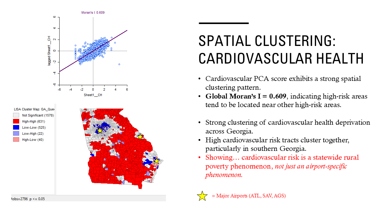
Spatial-statistical analysis showed that cardiovascular-health deprivation also clustered strongly, but high-risk areas were more broadly concentrated in southern and rural Georgia than around major airports.

10
Airport Proximity & Asthma Risk
Regression analysis tested whether living within five miles of a major airport was associated with asthma prevalence. The relationship was statistically significant, but airport proximity explained only a small share of total variation, indicating that other social and environmental factors remain important.

11
Airport Proximity & Cardiovascular Risk
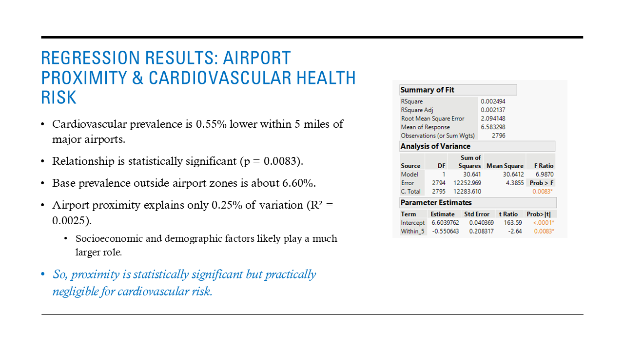
Cardiovascular prevalence was approximately 0.55 percentage points lower within five miles of major airports and the relationship was statistically significant (p = 0.0083), but the model explained only 0.25% of overall variation. The result suggests statistical association without meaningful practical explanatory power.

12
Key Findings & Planning Implications
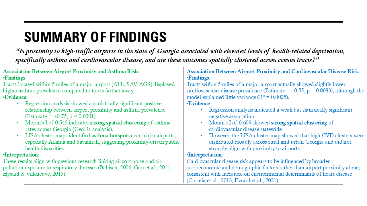
The project found different spatial stories for respiratory and cardiovascular health. Asthma showed a modest relationship with major-airport proximity, while cardiovascular risk appeared more strongly shaped by broader socioeconomic and geographic disparities. The findings highlight the value of combining environmental exposure analysis with social determinants of health in planning and public-health research.
- Research Question & Problem Formulation
- Asthma Patterns Around Georgia’s Major Airports
- Statewide Asthma Prevalence & Airport Locations
- Statewide Cardiovascular Health Patterns
- Cardiovascular Health Around Major Airports
- Respiratory Risk: Principal Component Analysis
- Cardiovascular Risk: Principal Component Analysis
- Spatial Clustering of Asthma
- Spatial Clustering of Cardiovascular Risk
- Airport Proximity & Asthma Risk
- Airport Proximity & Cardiovascular Risk
- Key Findings & Planning Implications
bottom of page